Keno's Home and Crestone's Official Weather Station
Crestone, Colorado
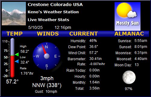
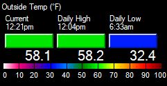
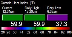
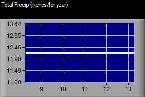
Local Weather Conditions
Updated every 10 Minutes
[Click on Refresh/Reload to Update Page]
Latitude: N 37.98 Longitude: W -105.68 Elevation: 8085 Feet
|
  |
|
|
|
|
|
|
|
 |
   |
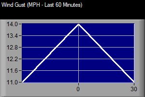
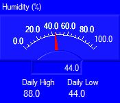
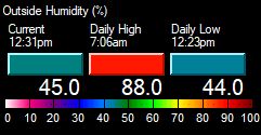
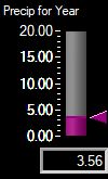
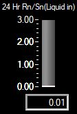
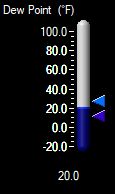
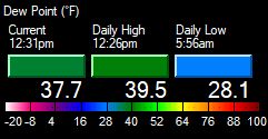
- Current Graphs - |
|
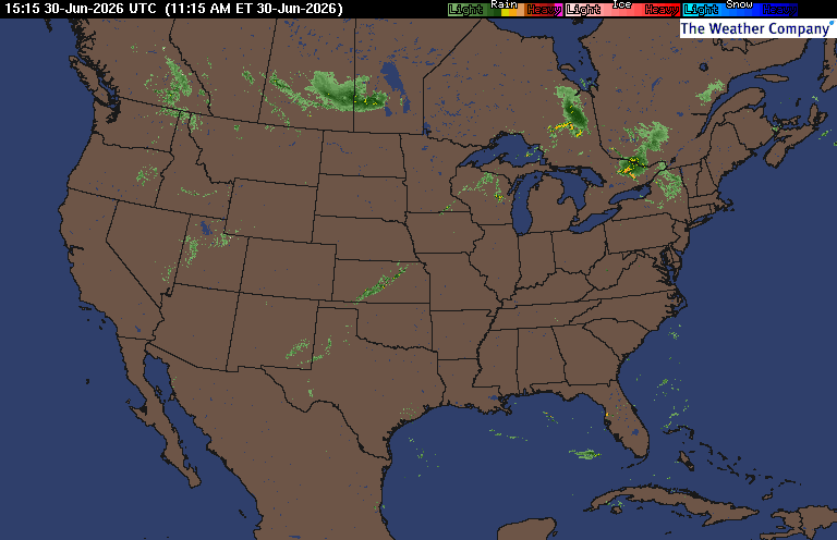
- Weather Conditions Nearby -
-
Click on
HERE for Colorado conditions elsewhere -
(See this
notice about these conditions)
![]() 30 Day
& 8 to 14 Day Outlooks /
Current
Drought info
30 Day
& 8 to 14 Day Outlooks /
Current
Drought info![]()
(From the NWS, updated at different times)
![]() First and last freeze dates for
Crestone/Baca
First and last freeze dates for
Crestone/Baca![]()
- Local Forecast -
(Updated: 924 AM MDT on June
30)
![]()
![]() 2 Red Flag Warnings & 1 Fire Weather Watch
2 Red Flag Warnings & 1 Fire Weather Watch
![]()
![]()
(for the entire area)
|
Today AM P. Sunny PM Breezy High 81°F |
Tonight Breezy early Late Smoke Low 45°F
Wednesday | AM Wildfire Smoke Breezy by late AM High 80°F
Wednesday |
Night Mostly Clear Breezy early Low 46°F
Thursday | Sunny & Breezy High 84°F
Thursday | Night Clear and Breezy early Low 46°F
Friday |  Sunny and Breezy High 88°F
Friday | Night  Clear & Breezy Low 49°F
Independence | Day  Mostly Sunny Warm High 86°F |
|
Weather Info
Forecast below is for the entire area, forecast above is for
around 8,000 feet only.... The normal high temperature today
around the Crestone/Baca area is 81°, record high is 95°,
the normal low is 48°, record low is
31°.
Click
here for the latest
Colorado Forecast Maps, and more.
Today
Another high fire danger
day today for the entire area... with
smoke in the morning, and dry once again... with hazy
sunshine... and a 10% chance for a shower late in the afternoon
in the higest foothills and mountains... High temps today below 10,000 feet of 71° to 84°, and with highs above 10,000 feet of
49° to 64°...
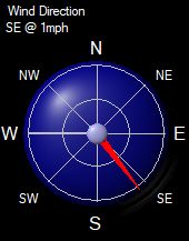
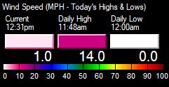
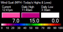
Breezy, with a southeast wind 5 to 10 mph becoming southwest 15 to 25 mph in the afternoon...
with gust as high as 35 mph.....
except windy above 11,000 feet with gusts as high as 45
mph.
Mostly clear...
but
with patchy
wildfire smoke
again after midnight... Low temps below 10,000 feet of 44° to 47°... with lows above
10,000 feet of 31° to 42°... Breezy, with a west southwest wind 15 to 25 mph becoming east northeast 5 to 10 mph in the evening... except windy
in the mountains above 11,500 feet.
Chances for Measurable Precip
Click on Image to Enlarge
Click
on Image for more Monarch Pass cams
Click
on Image for more Wolf Creek Pass cams
Click on Image for more Poncha Pass cams
Click on Image for more
La Veta Pass cams
Welcome to my home weather station. The station's
stats are recorded online every 6 to 10 minutes, 24 hours a day. My first
weather station went online back in 1999, when I lived in Manitou Sps, CO.
My second internet station went online in
2001, and began to collect data for Crestone, CO; in
November, 2002, it became Crestone's official weather station in
2006. This current online station started up in August of 2019.
(You can read more on this
here).
Please feel free to
email me with any comments you
might have. Keno
If you would like to help support the Crestone
Weather Center with a donation, you can do so by clicking below:
- More Crestone Weather Info -
| |||||||||||||||||||||||||