
Colorado Web Cams
Curecanti National Recreation Area
Blue Mesa, Colorado
(Note: This page may need reloading on some browsers for new views)
Curecanti National Recreation Area is located between Gunnison and Montrose along US Highway 50, on the Gunnison River in western Colorado and contains three reservoirs, Blue Mesa Reservoir, Morrow Point Reservoir and Crystal Reservoir. It sits adjacent to the Black Canyon of the Gunnison National Park. Created by the construction of Blue Mesa Dam in 1966, Blue Mesa Reservoir is Colorado's largest body of water. Curecanti is a popular destination for boating and fishing, and is also a popular area for ice-fishing in the winter months.
Curecanti National Recreation Area is managed by the National Park Service, with The Elk Creek Visitor Center a primary hub for information. Blue Mesa Reservoir is known for 96 miles / 155 kilometers of shoreline, boating, windsurfing, and fishing. It offers 10 campgrounds, including RV-friendly sites and boat-in options. Popular trails include the Dillon Pinnacles Trail. Boating Activities: Two marinas (Elk Creek and Lake Fork) are available, along with boat launches. Winter Activities include ice fishing and cross-country skiing. No entrance fee is charged for the area, though some activities, such as boating with a motor, require permits.
Blue Mesa, features a high-elevation, semi-arid climate characterized by hot, windy summers and severe, snowy winters. Temperatures range from -30°F
/-34.4°C (or lower) in winter to 85°F+/29.4°C in summer, with rapid, unpredictable weather shifts. The area receives low precipitation, averaging about 11 inches
/ 28 centimeters annually. The coldest temperature ever recorded at Blue Mesa Reservoir is
-47°F (-44°C), which occurred on December 25, 1924, while the warmest temp was
96°F (36°C) on July 22, 2005.
U.S. Hwy 50 at Blue Mesa Reservoir/span>
(Looking West)(from
CDOT)

Blue Mesa Reservoir, at U.S. Hwy 50 @ CR 26, looking
North
(from
CDOT)

U.S. Hwy 50 EB at CR 26 at Blue Mesa Reservoir: Looking East at Blue Mesa Bridge
(from
CDOT)

US 50 MP 135.50 EB at Blue Mesa Reservoir: Looking South at CR 26
(from CDOT)
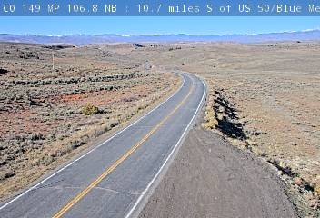
CO 149: 10.7 miles South of US 50/Blue Mesa Reservoir: Looking North
(from

CO 149 NB : 10.7 miles S of US 50/Blue Mesa Reservoir: Looking South
Blue Mesa Reservoir - Elk Creek
Marina
(from
National
Park Service)
Blue Mesa Reservoir- Lake Fork
(from
National
Park Service)
- Map -
| Colorado Web Cams | Gunnison | Crestone Weather Center |