
Hwy 135 North Bound Traffic
(from CDot)

Hwy 135 at 0.5 miles S of Red Lady Ave in Crested Butte: Looking South
Colorado Web Cams
Crested Butte, Colorado
(Note: This page may need reloading on some browsers for new views)
- Crested Butte -
Crested Butte is located in Gunnison County, Colorado, nestled in the heart of the Rocky Mountains at 8,885 feet / 2,720 meters, with this small town's population at 1,639 as of the 2020 US Census. A former coal mining town, today its known for great skiing and snowboarding, and also a destination for mountain biking and a variety of other outdoor activities.
The Town is known as "The Gateway to the Elk Mountains". The East River Valley where Crested Butte is located, was once used as a summer residence by the Ute people. However, they were quickly displaced after European explorers first entered the area and decided to stay.
The climate here is classified as a "Continental Subarctic Climate". The winter season is long, with bitterly cold spells along with short, clear days, and with massive amounts of snow. The coldest temperature ever recorded in Crested Butte is -47°F (-44°C), which occurred on February 6, 1982. The record snowfall amount ever seen in a season was 415 inches which fell in the winter of 1977/1978. The average snowfall per snow season is 203 inches / 516 centimeters.
While summers in town are generally mild with low humidity, and average July highs around 78°F ( 25.5°C), temperatures can occasionally reach up to 90°F (32°C). Crested Butte's all-time record high is 91°F (33°C), seen on August 25, 1936.
|
Hwy 135 North Bound Traffic (from CDot) |
Hwy 135 at 0.5 miles S of Red Lady Ave in Crested Butte: Looking South |
Whetstone Mountain, Crested Butte, CO
(from CVTV 10)
Elevation 12,527 ft. (3,818 m). The mountain is in the Gunnison National Forest of western Colorado, located 3 mi (4.8 km) south of Crested Butte.
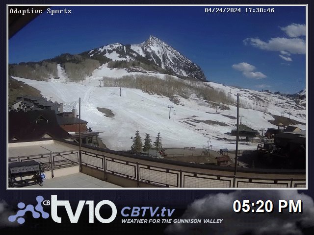
(from CVTV 10)
Note: The Gothic Mountain cam has moved to it's own, new page, see link below.
- Crested Butte Map -
| Colorado Web Cams | Gunnison | Gothic | Crestone Weather Center |