Colorado Web Cams
Grand Junction/Palisade, Colorado
The city of Grand Junction was named after the
Colorado River in 1882, back when the river was called the "Grand River" (The
"Colorado River" only held that name outside of Colorado before 1921, and was
renamed by the government at that time.). The "junction" part of the name comes
from and refers to the confluence of the Colorado and Gunnison rivers in the
city.
As of the 2020 census, the population of the city was
65,560. Grand Junction is the most populous city on the Colorado Western Slope
and is the home of the Colorado National Monument,
located close to the
city. The monument boasts canyons as deep as 500 feet and rock monoliths as tall as 450 feet.
The main road inside the park is the 23-mile-long Rim Rock Drive. There
are three tunnels along it's route, the longest is 530 feet long.
Palisade is a town in Mesa County, Colorado and is part of the Grand Junction Metropolitan Statistical Area. The population was 2,692 at the 2010 census.
The community was named for the cliffs near the town.
Grand Junction has a cold semi-arid climate.
Sitting in a large area of high desert lands in Western Colorado makes the
winters here cold and dry. Snowfall is low compared to the rest of Colorado, averaging 17.6 inches (45 cm) per season; only once in the entire period of record dating to 1893, has 10 inches (25 cm)
of snow fallen in a calendar day. Summers here are hot and dry and averages 68 days a year with temperatures at 90°F (32°C) or above, and an average 8 days attaining 100°F (38°C) or more. The area receives little
liquid precipitation year-round, averaging 9.05 inches (22.9 cm). Hottest ever
temperature was on July 17, 2023 when the thermometer reached 107°F (41.7°C), and the coldest ever reading was -24°F (-32°C) on January 13, 1963.
(Note: This page may need reloading on some browsers for new views)
1.1 miles E of Horizon Dr in Grand Junction
(CDOT Cam)
|
- Next cam from the Colorado National
Monument -
This cam now has a new page of its own, to free up space on this page; see
its new link down below
|
- Next cams from Palisade, CO -
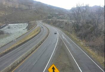
Palisade - northeast of Grand Junction, I-70 looking east
(from the CDOT)

Palisade - northeast of Grand Junction, I-70 looking west
(from the CDOT)

Beaver Tail Tunnel (I-70 eastbound)
(from the CDOT)

I-70 EB at Loma Port of Entry: Looking West
(from the CDOT)
- Next 2 cams is from the
Colorado/Utah border -

I-70 at the Colorado/Utah border,
to the west of Grand Junction

I-70 at the Colorado/Utah border,
to the west of Grand Junction
-
Map -
View Larger Map